Remembering Floyd -
Maps and Statistics
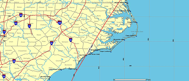
National Oceanic and Atmospheric Administration -- Floyd's track though North Carolina
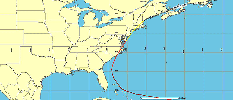
National Oceanic and Atmospheric Administration -- Floyd's track though the United States
Floyd Facts
The approach
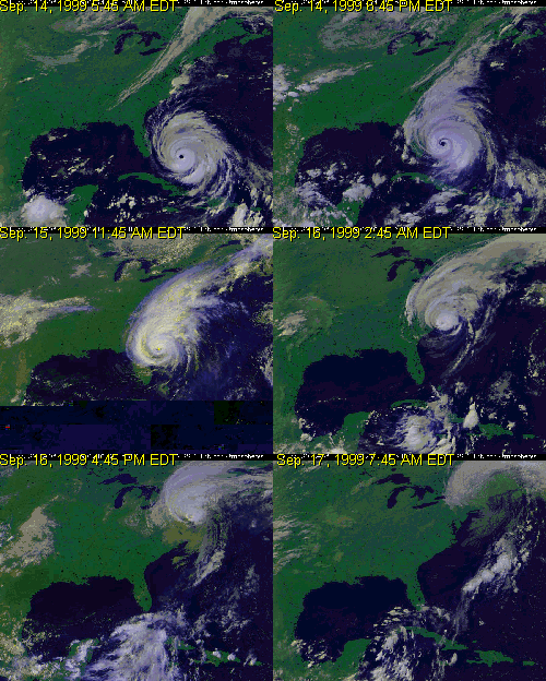
First detected off Africa Sept. 2
Upgraded to tropical depression Sept. 7
Upgraded to tropical storm Sept. 8
Upgraded to hurricane Sept. 10
Became a Category 4 hurricane Sept. 13, approaching the Bahamas
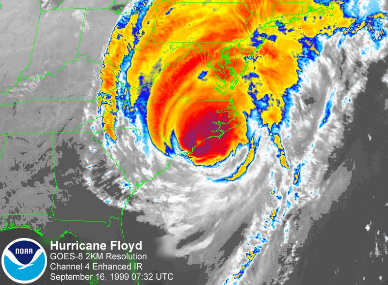
Center of storm hit Cape Fear as a Category 2 hurricane Sept. 16
 The impact
North Carolina:
• 35 deaths
• More than 1,500 people rescued from flooded areas within 24 hours, more than 3,500 by Sept. 18
• 7,000 homes destroyed, 17,000 homes uninhabitable, 56,000 homes damaged
• Most roads east of I-95 flooded
• More than 500,000 people without electricity, 10,000 people in temporary shelters
• Estimated $634 million total agricultural losses, including 30,000 hogs, 700,000 turkeys and 2.4 million chickens lost
-- "Nothing since the Civil War has been as destructive to families here ... The recovery process will be much longer than the water-going-down process," H. David Bruton, state Secretary of Health and Human Services.
 Wayne County
• 2 deaths
• 10 percent of county's 550 square miles flooded
• 80 percent of roads affected -- of 1,100 miles of road, 700 miles impassable, U.S. 70 and U.S. 117 closed, Rosewood traffic routed through Pikeville, Kinston traffic routed through N.C. 55, Mount Olive traffic routed through Newton Grove and Kinston
• 2,300 homes and businesses affected -- 300 homes bought out in Wayne County, 297 homes bought out in Goldsboro, $15.5 million spent in buyout funds
• 5 shelters opened with more than 2,000 people seeking shelter; 75 percent of county without power
• Agricultural losses -- 170,000 chickens and 107,000 turkeys, but no hogs or livestock
Tobacco: 6,785 acres, 35 percent loss. Rick Tharrington of the FSA noted that the tobacco lost in the field was the higher-priced upper-stalk leaves.
Cotton: 3,500 acres were flooded and were a total loss. Total acreage was 27, 804 with a 37 percent loss.
Corn: 1,000 acres were flooded and were a total loss. Total acreage was 19,079 for a 40 percent loss.
Soybeans: 3,500 acres were flooded for a 75 percent loss. Total acreage was 61,866 for a 15 percent loss.
Sweet potatoes: 1,795 acres, 98 percent loss.
Fall cucumbers: 364 acres, 100 percent loss.
(Crop losses include Hurricane Dennis)
* state figures from National Weather Service
* Local figures from Wayne County Emergency Services and Wayne County Farm Service Agency
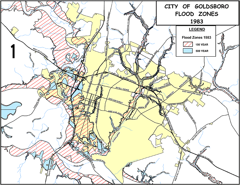
City of Goldsboro -- Flood zones as of 1983 (click for larger PDF)
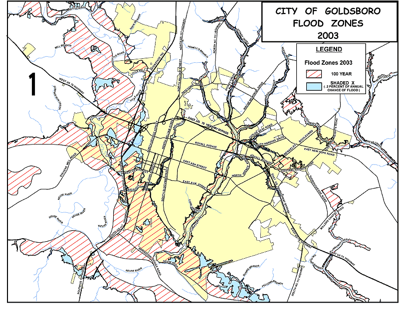
City of Goldsboro -- Flood zones as of 2003 (click for larger PDF)
To see more Wayne maps, perhaps to check if your own house is in the flood zone
go to the Wayne County GIS site.
